Air Travel and Euler
 The maps that pilots use are called
route maps. Route maps show the paths of the airplanes from one destination
to another. Here is an example of an actual route map from Frontier Airlines.
The center for all travel with this airline is in Denver, Colorado. From
there you can travel to some of the major cities in the surrounding states.
The maps that pilots use are called
route maps. Route maps show the paths of the airplanes from one destination
to another. Here is an example of an actual route map from Frontier Airlines.
The center for all travel with this airline is in Denver, Colorado. From
there you can travel to some of the major cities in the surrounding states.
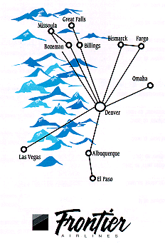 Can you decide whether
the above route map is a circuit, path or neither?
Can you decide whether
the above route map is a circuit, path or neither?
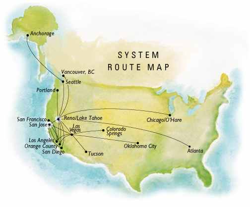
Below is another route map. This
map is used by Reno Air which is based in Reno, Nevada. The graph that
is made from the destinations (vertices) and the connections made among
the desitnations (arcs) is a bit more complex than the graph from Frontier
Airlines. There are many more cities as well as ways to get from one city
to the next.
 To analyze the above network,
it might be easiest to redraw the graph
so that the cities are
more spread out.
Now can you tell if this
map is a circuit or a path, or is it neither?
To analyze the above network,
it might be easiest to redraw the graph
so that the cities are
more spread out.
Now can you tell if this
map is a circuit or a path, or is it neither?
Application
page Museum
application World
application